 Introduction page
Part 1 - Fiji
Part 2 - Australia
Home page
Part 3 - New Zealand
South Island
North Island
Back to top
Last updated February 27, 2000
 Well, we now started the last leg of the South Pacific Adventure, a 10 day journey
through both south and north islands of New Zealand. To see a map of
New Zealand, click on the link. Except for the
Trans Alpine railroad trip to Greymouth, all our traveling was by
rental car. This has to be the only way to see the country.
To stop, gawk, and wonder. Then drive on again.
Well, we now started the last leg of the South Pacific Adventure, a 10 day journey
through both south and north islands of New Zealand. To see a map of
New Zealand, click on the link. Except for the
Trans Alpine railroad trip to Greymouth, all our traveling was by
rental car. This has to be the only way to see the country.
To stop, gawk, and wonder. Then drive on again.
Only one word can describe New Zealand.
 WOW!
WOW!
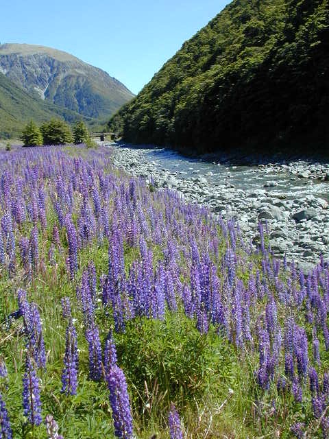
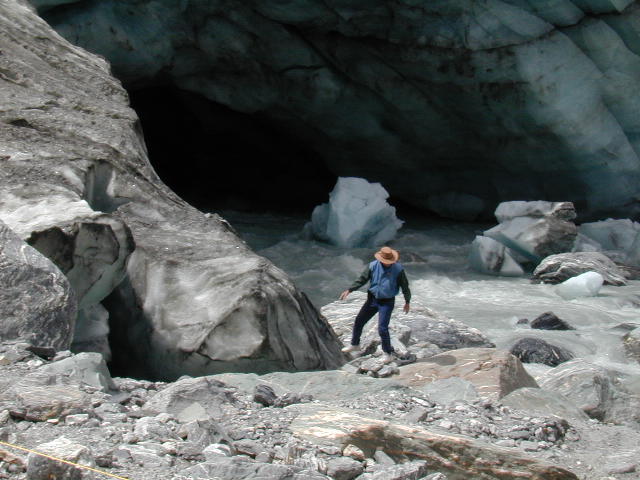
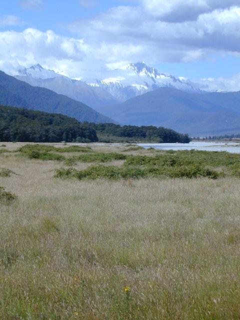
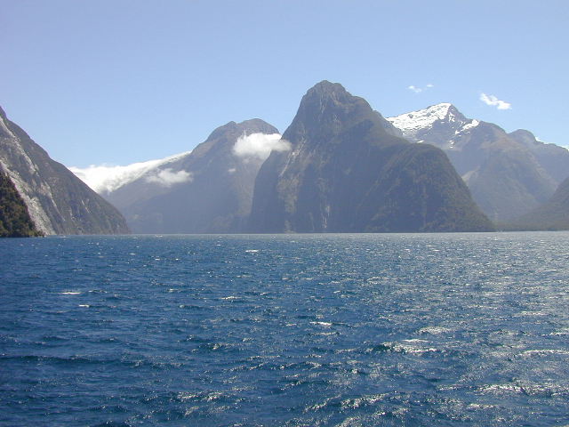
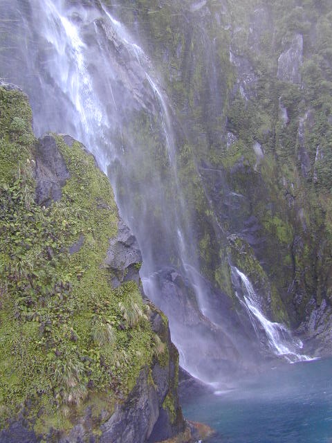
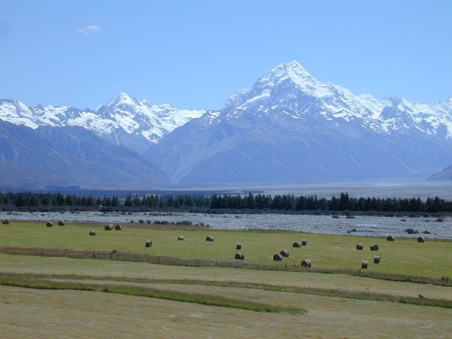
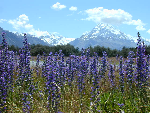
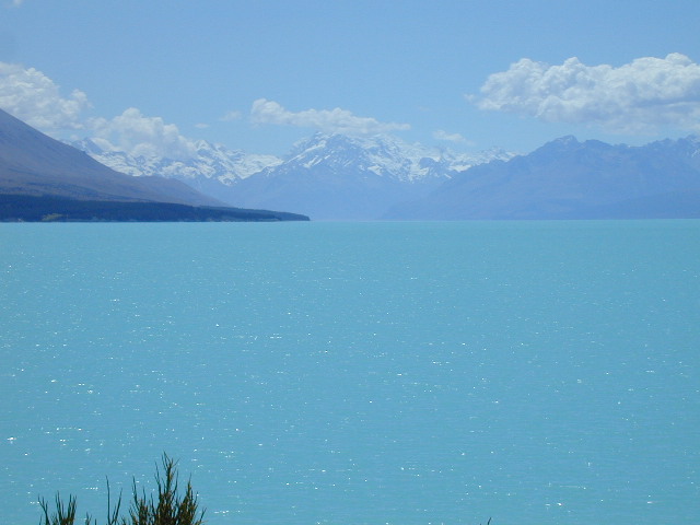
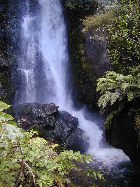
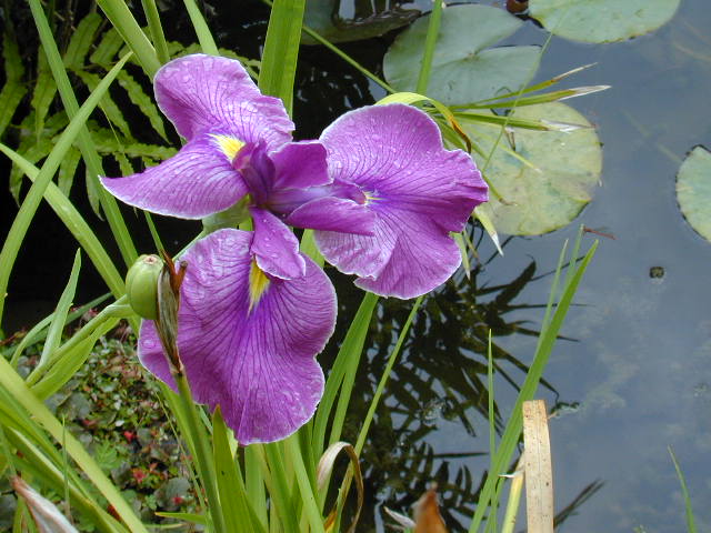
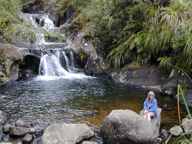
 Never before have we seen such georgeous and immense landscape scenery.
Mountains, glaciers, gorges, rivers, lakes, panoramas like none to be seen
anywhere else. Simply magnificent. The photos included in this section
are only a few of the many we took. There isn't enough disk space here to
show all that I'd like to. But I've tried to show some representative shots
that might entice anyone who has been there, to go back again and for
those who haven't been fortunate enough to get there yet, to start planning
a longer trip than we had.
Never before have we seen such georgeous and immense landscape scenery.
Mountains, glaciers, gorges, rivers, lakes, panoramas like none to be seen
anywhere else. Simply magnificent. The photos included in this section
are only a few of the many we took. There isn't enough disk space here to
show all that I'd like to. But I've tried to show some representative shots
that might entice anyone who has been there, to go back again and for
those who haven't been fortunate enough to get there yet, to start planning
a longer trip than we had.
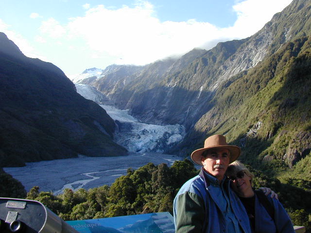
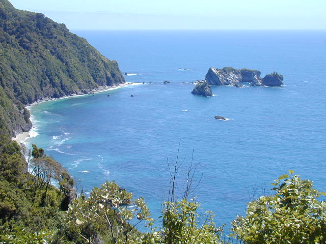
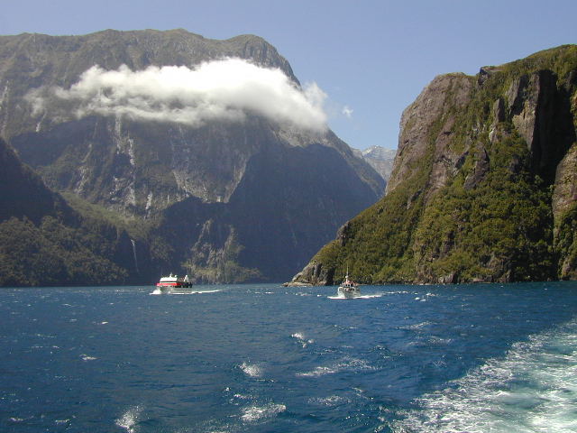
 In a nutshell, we went from Christchurch to Greymouth to
Franz Josef to Queenstown to Milford
Sound to Mt. Cook to Christchurch to Rotorua
to Thames to Auckland and back to the states. In all its glory, I don't think I've seen
so great an area be so totally beautiful and scenic as the south island. Sure,
Bora Bora is fantastic, but it is small. Sure, Yosemite is impressive, but it is
small. The Grand Canyon stands alone, but the glaciers and mountain ranges and
rivers and jungles and forests of New Zealand are unmatched in my experience.
In a nutshell, we went from Christchurch to Greymouth to
Franz Josef to Queenstown to Milford
Sound to Mt. Cook to Christchurch to Rotorua
to Thames to Auckland and back to the states. In all its glory, I don't think I've seen
so great an area be so totally beautiful and scenic as the south island. Sure,
Bora Bora is fantastic, but it is small. Sure, Yosemite is impressive, but it is
small. The Grand Canyon stands alone, but the glaciers and mountain ranges and
rivers and jungles and forests of New Zealand are unmatched in my experience.
 The country, as well as the cities are immaculate. You just don't see litter
anywhere. Billboards are practically unheard of outside Christchurch.
There are only 3.5 million inhabitatants, only 900K of them in the south,
most of them in Christchurch and Dunedin. That makes for many hours of
driving in the wide open spaces.
The country, as well as the cities are immaculate. You just don't see litter
anywhere. Billboards are practically unheard of outside Christchurch.
There are only 3.5 million inhabitatants, only 900K of them in the south,
most of them in Christchurch and Dunedin. That makes for many hours of
driving in the wide open spaces.
 Some interesting observations of our time in NZ:
There are approximately 1.1 smushed possums per km of highway in the country.
Serious possum population! Radio stations love to play the U.S. 'oldies' music
and many restaurants are 'oldies' themed. Most roads, even in the towns and
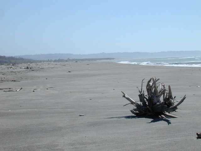
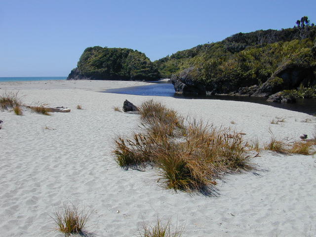
villages, do not have curbs. The west side of the south island is nearly
deserted, with few towns, fewer people, and the best scenery anywhere.
 One highway feature I found interesting, is that they will take a normal single
lane road, paint a divider line down the middle and call it a two lane road.
These are particularly fun to negotiate on dark mountain roads that typically
have never seen a guard rail. Small stores love to wrap your purchases in bags
with lots of tape.
One highway feature I found interesting, is that they will take a normal single
lane road, paint a divider line down the middle and call it a two lane road.
These are particularly fun to negotiate on dark mountain roads that typically
have never seen a guard rail. Small stores love to wrap your purchases in bags
with lots of tape.
 Every town has public toilets that are immaculately maintained. Or maybe New
Zealanders are just not as messy as Americans. Also you'll only find electric hot air hand driers. Paper
towels are apparently on the endangered species list 'down under.' Many small towns also have clock towers in the center of town. And they all seem to work!
Every town has public toilets that are immaculately maintained. Or maybe New
Zealanders are just not as messy as Americans. Also you'll only find electric hot air hand driers. Paper
towels are apparently on the endangered species list 'down under.' Many small towns also have clock towers in the center of town. And they all seem to work!
 New Zealand! A fabulous place with friendly English speaking (sort of)
people. The Kiwis have great beer, excellent food, low prices (except gasoline),
litter-free highways and towns, lots of sheep (20:1), lots of cattle,
clean air, spectacular scenery, and the America's Cup in yachting!
New Zealand! A fabulous place with friendly English speaking (sort of)
people. The Kiwis have great beer, excellent food, low prices (except gasoline),
litter-free highways and towns, lots of sheep (20:1), lots of cattle,
clean air, spectacular scenery, and the America's Cup in yachting!
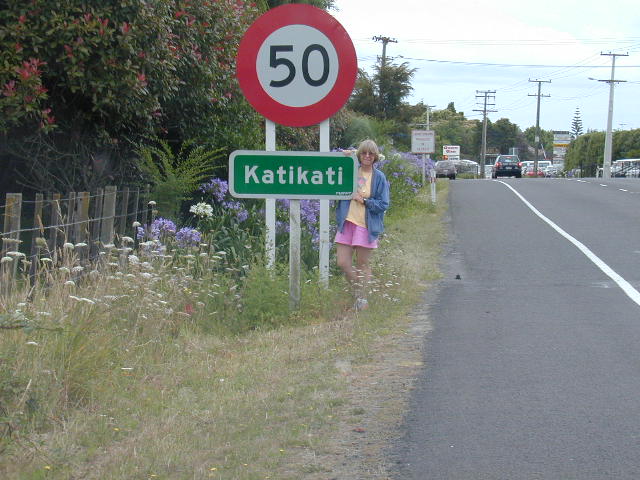
 The north island of New Zealand is a bit warmer than the south, as it is
considerably closer to the equator, but Auckland is at about the same
latitude as Melbourne, at the south of Australia, so it is not exactly
tropical. However the north island has a number of geologically active
areas, including volcanoes and thermal areas, much like Yellowstone in
the U.S. To see a map of New Zealand, click on the link.
The north island of New Zealand is a bit warmer than the south, as it is
considerably closer to the equator, but Auckland is at about the same
latitude as Melbourne, at the south of Australia, so it is not exactly
tropical. However the north island has a number of geologically active
areas, including volcanoes and thermal areas, much like Yellowstone in
the U.S. To see a map of New Zealand, click on the link.
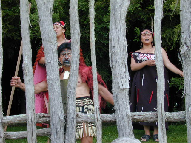 There is a former Maori village near Rotorua that was buried in volcanic ash
in1886 during a period of heavy volcanic activity in the area. This has been
largely excavated and is now a tourist area. There are also two hot springs/geyser/mud
pot areas with strong similarities to Yellowstone, albeit not as large.
There is a former Maori village near Rotorua that was buried in volcanic ash
in1886 during a period of heavy volcanic activity in the area. This has been
largely excavated and is now a tourist area. There are also two hot springs/geyser/mud
pot areas with strong similarities to Yellowstone, albeit not as large.
 75% of the population of New Zealand lives in the north, with about 1 million
living in Auckland. We spent most of our time in the northern half of the island,
traveling from Rotorua with its sulfur/hydrogen sulfide smell permeating
everything, up to the Coromandel Peninsula, east of Auckland, which is
apparently a resort area for Auckland residents.
75% of the population of New Zealand lives in the north, with about 1 million
living in Auckland. We spent most of our time in the northern half of the island,
traveling from Rotorua with its sulfur/hydrogen sulfide smell permeating
everything, up to the Coromandel Peninsula, east of Auckland, which is
apparently a resort area for Auckland residents.
 The peninsula area is very scenic and the road there is somewhat mountainous
with many switchbacks on the famous 'two lane' roads. That is, single lane
roads with a stripe painted in the middle, thereby making it two lanes. Yeah, right!
Much of the peninsula coastal area has high cliffs with sheer drops to the sea.
The peninsula area is very scenic and the road there is somewhat mountainous
with many switchbacks on the famous 'two lane' roads. That is, single lane
roads with a stripe painted in the middle, thereby making it two lanes. Yeah, right!
Much of the peninsula coastal area has high cliffs with sheer drops to the sea.
 The trip to New Zealand after having been to Fiji and Australia, was certainly a
high point. Katie was talking about going back there to live for a year or so.
It really is that beautiful, and the cost of living, compared to the U.S., is
extremely reasonable, with an exchange rate of about $1.90 NZ for every $1.00
U.S. Prices for most items seemed to be reasonably close to that of the U.S.,
until you realized that we were paying about half price because of the exchange rate!
The trip to New Zealand after having been to Fiji and Australia, was certainly a
high point. Katie was talking about going back there to live for a year or so.
It really is that beautiful, and the cost of living, compared to the U.S., is
extremely reasonable, with an exchange rate of about $1.90 NZ for every $1.00
U.S. Prices for most items seemed to be reasonably close to that of the U.S.,
until you realized that we were paying about half price because of the exchange rate!
 visitors since 2/14/2000